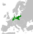
Plik:Kingdom of Prussia 1870.svg

Ôryginalny zbiōr (Zbiōr SVG, nōminalnie 450 × 456 pikselōw, srogość zbioru: 705 KB)
Tyn zbiōr je ze Wikimedia Commons i może być używany we inkszych projektach. Ôpis na jego zajcie ôpisu zbioru je pokŏzany pod.
Ôpis
Licyncyjŏ
- Idzie:
- udostympniać – kopiować, rozkludzać i przekazować dzieło
- modyfikować – adaptować dzieło
- Pod tymi warōnkami:
- uznanie autorstwa – Musisz ôkryślić autorstwo, podać link do licyncyje, i skŏzać, czy dzieło było zmiyniōne. Możesz to zrobić kożdym usōndnym spusobym, ale niy tak, żeby sugerować, że posiedziciel licyncyje spiyrŏ Ciebie abo Twoje użycie dzieła.
- trzim licyncyjõ – Jeźli zmiyniŏsz abo budujesz na tyj materyji, musisz swoje dzieło rozkludzać na takij samyj abo zgodliwyj licyncyji, jak we ôryginale.
Podpisy
Obiekty przedstawione na tym zdjęciu
przedstawia polski
status praw autorskich polski
chroniony prawem autorskim polski
31 mŏj 2016
Gyszichta zbioru
Kliknij w datã/czas, żeby ôbejzdrzeć zbiōr, jak wtynczŏs wyglōndoł.
| Data i czas | Miniatura | Wymiary | Używŏcz | Kōmyntŏrz | |
|---|---|---|---|---|---|
| terŏźnŏ | 03:54, 1 czy 2016 |  | 450 × 456 (705 KB) | Alphathon | Various corrections to the states of the North German Confederation |
| 06:22, 31 mŏj 2016 |  | 450 × 456 (662 KB) | Alphathon | Minor corrections (Tarasp and post-1818 German Confederation border change) | |
| 03:40, 31 mŏj 2016 |  | 450 × 456 (662 KB) | Alphathon | == {{int:filedesc}} == {{Inkscape}} {{Information |Description={{en|A map of the en:Kingdom of Prussia within the North German Confederation and within Europe circa 1870 CE.}} |Source= {{Derived from|Blank_map_of_Europe.svg|display=50}} |Da... |
Użycie zbioru
Ta strōna używŏ tego zbioru:
Globalne użycie zbioru
Tyn zbiōr je używany tyż we inkszych projektach wiki:
- Użycie we af.wiktionary.org
- Użycie we ar.wikipedia.org
- Użycie we bn.wikipedia.org
- Użycie we ckb.wikipedia.org
- Użycie we en.wikipedia.org
- Użycie we eo.wiktionary.org
- Użycie we es.wikipedia.org
- Użycie we es.wiktionary.org
- Użycie we eu.wikipedia.org
- Użycie we fa.wikipedia.org
- Użycie we fi.wikipedia.org
- Użycie we he.wikipedia.org
- Użycie we hu.wikipedia.org
- Użycie we is.wikipedia.org
- Użycie we it.wikipedia.org
- Użycie we li.wiktionary.org
- Użycie we lld.wikipedia.org
- Użycie we lt.wikipedia.org
- Użycie we mn.wikipedia.org
- Użycie we pl.wikipedia.org
- Użycie we pt.wikipedia.org
- Użycie we rue.wikipedia.org
- Użycie we ru.wikipedia.org
- Użycie we ru.wiktionary.org
- Użycie we sk.wikipedia.org
- Użycie we tr.wikipedia.org
- Użycie we uk.wikipedia.org
- Użycie we uz.wikipedia.org
- Użycie we xmf.wikipedia.org
- Użycie we zh-yue.wikipedia.org
- Użycie we zh.wikipedia.org
Metadane
We tym zbiorze sōm ekstra informacyje pewnikym przidane ôd fotoaparatu abo skanera użytego do zrobiyniŏ abo zdigitalizowaniŏ go.
Jeźli zbiōr bōł modyfikowany, niykere informacyje mogōm niy cołkym ôdpowiadać zmodyfikowanymu zbiorowi.
| Krótki tytuł | Kingdom of Prussia ca. 1870 |
|---|---|
| Titel uobrozka | A map of the Kingdom of Prussia within the North German Confederation and within Europe circa 1870.
Released under CreativeCommons Attribution-ShareAlike 4.0 (CC BY-SA 4.0; https://creativecommons.org/licenses/by-sa/4.0/) by Wikimedia Commons user Alphathon (https://commons.wikimedia.org/wiki/User:Alphathon) The map is based on https://commons.wikimedia.org/wiki/File:Blank_map_of_Europe.svg. The metadata description for that file is contained below: A blank Map of Europe. Every country has an id which is its ISO-3166-1-ALPHA2 code in lower case. Members of the EU have a class="eu", countries in europe (which I found turkey to be but russia not) have a class="europe". Certain countries are further subdivided the United Kingdom has gb-gbn for Great Britain and gb-nir for Northern Ireland. Russia is divided into ru-kgd for the Kaliningrad Oblast and ru-main for the Main body of Russia. There is the additional grouping #xb for the "British Islands" (the UK with its Crown Dependencies - Jersey, Guernsey and the Isle of Man) Contributors. Original Image: (http://commons.wikimedia.org/wiki/Image:Europe_countries.svg) Júlio Reis (http://commons.wikimedia.org/wiki/User:Tintazul). Recolouring and tagging with country codes: Marian "maix" Sigler (http://commons.wikimedia.org/wiki/User:Maix) Improved geographical features: http://commons.wikimedia.org/wiki/User:W!B: Updated to reflect dissolution of Serbia & Montenegro: http://commons.wikimedia.org/wiki/User:Zirland Updated to include British Crown Dependencies as seperate entities and regroup them as "British Islands", with some simplifications to the XML and CSS: James Hardy (http://commons.wikimedia.org/wiki/User:MrWeeble) Validated (http://commons.wikimedia.org/wiki/User:CarolSpears) Changed the country code of Serbia to RS per http://en.wikipedia.org/wiki/Serbian_country_codes and the file http://www.iso.org/iso/iso3166_en_code_lists.txt (http://commons.wikimedia.org/wiki/User:TimothyBourke) Uploaded on behalf of User:Checkit, direct complaints to him plox: 'Moved countries out of the "outlines" group, removed "outlines" style class, remove separate style information for Russia' (http://commons.wikimedia.org/wiki/User:Collard) Updated various coastlines and boarders and added various islands not previously shown (details follow). Added Kosovo and Northern Cyprus as disputed territories. Moved major lakes to their own object and added more. List of updated boarders/coastlines: British Isles (+ added Isle of Wight, Skye, various smaller islands), the Netherlands, Germany, Czech Republic, Denmark, Sweden, Finland, Poland, Kaliningrad Oblast of the Russian Federation (and minor tweaks to Lithuania), Ukraine, Moldova (minor), Romania, Bulgaria, Turkey, Greece, F.Y.R. Macedonia, Serbia, Bosnia and Herzegovina, Montenegro, Albania, Croatia, Italy (mainland and Sicily), Malta (http://commons.wikimedia.org/wiki/User:Alphathon). Added Bornholm (http://commons.wikimedia.org/wiki/User:Heb)Released under CreativeCommons Attribution ShareAlike (http://creativecommons.org/licenses/by-sa/2.5/). |
| Szyrokość | 450 |
| Wysokość | 456 |


