
Plik:East Germany 1956-1990.svg

Wielkość pliku podglądu PNG dla pliku SVG: 450 x 456 pikselōw Inksze rozdzielczości: 237 x 240 pikselōw | 474 x 480 pikselōw | 758 x 768 pikselōw | 1011 x 1024 pikselōw | 2021 x 2048 pikselōw.
Ôryginalny zbiōr (Zbiōr SVG, nōminalnie 450 × 456 pikselōw, srogość zbioru: 474 KB)
Ôpis


.svg)
.svg)
.svg)
.svg)
.svg)


.svg)
.svg)
.svg)


.png)
.png)


.svg)


.svg)

.svg)


.svg)
.svg)
.svg)
.svg)


.svg)
.png)


.svg)


.svg)
.svg)


.svg)


.svg)


.svg)
.svg)
.svg)
.svg)
.svg)
.svg)
.svg)
_cropped.svg)
.svg)
.svg)
.svg)
.svg)
.svg)
.svg)
.svg)
.svg)
.svg)
.svg)
.svg)
.svg)
.svg)
.svg)
.svg)
.svg)
.svg)
.svg)
.svg)
.svg)
.svg)
.svg)
.svg)
.svg)
.svg)
.svg)
.svg)
.svg)
.svg)
.svg)
.svg)
.svg)
.svg)
.svg)
.svg)
.svg)
.svg)
.svg)
.svg)
.svg)
.svg)
.svg)
.svg)
.svg)
.svg)
| To zdjęcie było poddane obróbce cyfrowej i może różnić się od wersji oryginalnej. Zmiany: {{{1}}}. Oryginał można obejrzeć tu: Blank map of Europe 1956-1990.svg:
|
Licyncyjŏ
Ja, właściciel praw autorskich do tego dzieła, udostępniam je na poniższej licencji
Tyn zbiōr podlygŏ licyncyji Creative Commons Uznanie autorstwa – Na tych samych warōnkach 3.0.
- Idzie:
- udostympniać – kopiować, rozkludzać i przekazować dzieło
- modyfikować – adaptować dzieło
- Pod tymi warōnkami:
- uznanie autorstwa – Musisz ôkryślić autorstwo, podać link do licyncyje, i skŏzać, czy dzieło było zmiyniōne. Możesz to zrobić kożdym usōndnym spusobym, ale niy tak, żeby sugerować, że posiedziciel licyncyje spiyrŏ Ciebie abo Twoje użycie dzieła.
- trzim licyncyjõ – Jeźli zmiyniŏsz abo budujesz na tyj materyji, musisz swoje dzieło rozkludzać na takij samyj abo zgodliwyj licyncyji, jak we ôryginale.
Oryginalny rejestr przesyłania
This image is a derivative work of the following images:
- File:Blank_map_of_Europe_1956-1990.svg licensed with Cc-by-sa-3.0
- 2011-10-30T04:43:42Z Alphathon 450x456 (485146 Bytes) == {{int:filedesc}} == {{Information |Description={{en|Blank map of Europe showing national borders as they stood from 1956-1990.}} |Source=*[[:File:Blank_map_of_Europe.svg|]] |Date=2011-10-30 04:42 (UTC) |Author=*[[:File:Bla
Gyszichta zbioru
Kliknij w datã/czas, żeby ôbejzdrzeć zbiōr, jak wtynczŏs wyglōndoł.
| Data i czas | Miniatura | Wymiary | Używŏcz | Kōmyntŏrz | |
|---|---|---|---|---|---|
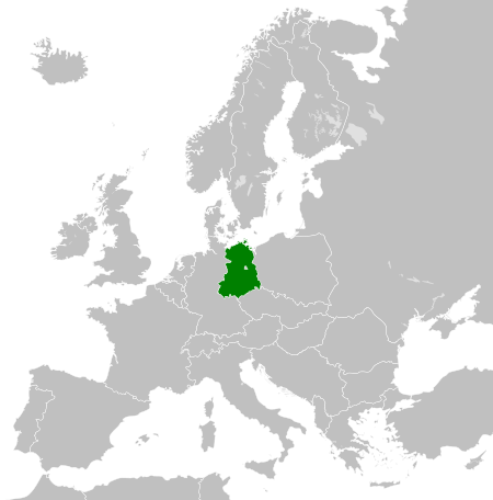
| terŏźnŏ | 02:33, 26 lis 2011 | | 450 × 456 (474 KB) | StalwartUK | == {{int:filedesc}} == {{Information |Description={{en|Map of the East Germany (German Democratic Republic) as it was from 1949-1990. Surrounding countries accurate from 1956-1990.}} |Source=*[[:File:Blank_map_of_Europe_1956-1990.svg| |
Użycie zbioru
Ta strōna używŏ tego zbioru:
Globalne użycie zbioru
Tyn zbiōr je używany tyż we inkszych projektach wiki:
- Użycie we af.wikipedia.org
- Użycie we am.wikipedia.org
- Użycie we an.wikipedia.org
- Użycie we ar.wikipedia.org
- Użycie we ast.wikipedia.org
- Użycie we azb.wikipedia.org
- Użycie we az.wikipedia.org
- Użycie we ba.wikipedia.org
- Użycie we be.wikipedia.org
- Użycie we bs.wikipedia.org
- Użycie we ca.wikipedia.org
- Użycie we ce.wikipedia.org
- Użycie we cs.wikipedia.org
- Użycie we de.wikipedia.org
- Użycie we de.wiktionary.org
- Użycie we diq.wikipedia.org
- Użycie we el.wikipedia.org
- Użycie we en.wikipedia.org
- Użycie we en.wiktionary.org
- Użycie we eo.wikipedia.org
- Użycie we es.wikipedia.org
- Użycie we es.wiktionary.org
- Użycie we eu.wikipedia.org
- Użycie we ext.wikipedia.org
- Użycie we fa.wikipedia.org
- Użycie we fi.wikipedia.org
- Użycie we fr.wikipedia.org
- Użycie we fr.wiktionary.org
- Użycie we ga.wikipedia.org
- Użycie we gd.wikipedia.org
- Użycie we gl.wikipedia.org
- Użycie we gv.wikipedia.org
- Użycie we he.wikipedia.org
- Użycie we hi.wikipedia.org
- Użycie we hr.wikipedia.org
- Użycie we hr.wiktionary.org
- Użycie we hsb.wikipedia.org
- Użycie we hu.wikipedia.org
- Użycie we hy.wikipedia.org
- Użycie we ia.wikipedia.org
- Użycie we id.wikipedia.org
- Użycie we is.wikipedia.org
- Użycie we it.wikipedia.org
Pokŏż listã globalnego użyciŏ tego zbioru.