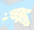
Plik:Estonia adm location map.svg

Treść strony nie jest dostępna w innych językach.
Ze Wikipedia

Ôryginalny zbiōr(Zbiōr SVG, nōminalnie 1666 × 1484 pikselōw, srogość zbioru: 349 KB)

Tyn zbiōr je ze Wikimedia Commons i może być używany we inkszych projektach. Ôpis na jego zajcie ôpisu zbioru je pokŏzany pod.

Ôpis

Ôpis
Deutsch: Positionskarte von Estland
English: Location map of Estonia

Equirectangular projection, vertical stretching 192 %
Border coordinates

60.4
21.5←↕→28.4
57.2
 Info This map is part of a series of location maps with unified standards: SVG as file format, standardised colours and name scheme. The boundaries on these maps always show the de facto situation and do not imply any endorsement or acceptance. In case of changes of the shown area the file is updated. The old version will be uploaded as a new file and thus is still available.
Data
Zdrzōdło

Praca własna przy użyciu:

  • United States National Imagery and Mapping Agency data
  • World Data Base II data
Autōr NordNordWest
Inksze wersyje
Kartenwerkstatt
Ta mapa została stworzona lub ulepszona w niemieckiej Kartenwerkstatt (Pracowni Kartograficznej). I Ty możesz zaproponować inne mapy do ulepszenia.

Licyncyjŏ

Usage of this file with:

explanatory notes: Legally binding is only the full legalcode. For a free usage I recommend to respect the following licence conditions:
1. Provide my name as given above: NordNordWest,
2. a copy of, or the URI for, the applicable license: https://creativecommons.org/licenses/by-sa/3.0/de/legalcode,
3. the title of the work,
4. in the case of an adaptation, a credit identifying the use of the work in the adaptation.
This license and the rights granted hereunder will terminate automatically upon any breach by you of the terms of this license. Any of the above conditions can be waived if you get permission from the copyright holder. If you have questions or wish differing conditions, please contact me through nnwest@t-online.de or my discussion page

w:pl:Licencje Creative Commons
uznanie autorstwa trzim licyncyjõ
Uznanie autorstwa: Karte: NordNordWest, Lizenz: Creative Commons by-sa-3.0 de
Idzie:
  • udostympniać – kopiować, rozkludzać i przekazować dzieło
  • modyfikować – adaptować dzieło
Pod tymi warōnkami:
  • uznanie autorstwa – Musisz ôkryślić autorstwo, podać link do licyncyje, i skŏzać, czy dzieło było zmiyniōne. Możesz to zrobić kożdym usōndnym spusobym, ale niy tak, żeby sugerować, że posiedziciel licyncyje spiyrŏ Ciebie abo Twoje użycie dzieła.
  • trzim licyncyjõ – Jeźli zmiyniŏsz abo budujesz na tyj materyji, musisz swoje dzieło rozkludzać na takij samyj abo zgodliwyj licyncyji, jak we ôryginale.

Podpisy

Wyekleruj we jednyj linijce, co tyn zbiōr pokazuje
Obraz przedstawia mapę Estonii.

Obiekty przedstawione na tym zdjęciu

przedstawia polski

Gyszichta zbioru

Kliknij w datã/czas, żeby ôbejzdrzeć zbiōr, jak wtynczŏs wyglōndoł.

Data i czasMiniaturaWymiaryUżywŏczKōmyntŏrz
terŏźnŏ20:27, 26 mar 2022Miniatura wersyje 20:27, 26 mar 20221666 × 1484 (349 KB)NordNordWestupd
19:17, 8 lis 2017Miniatura wersyje 19:17, 8 lis 20171666 × 1391 (346 KB)NordNordWestcorr
16:05, 5 lis 2017Miniatura wersyje 16:05, 5 lis 20171666 × 1391 (346 KB)NordNordWestupd
19:19, 24 wrz 2014Miniatura wersyje 19:19, 24 wrz 20141666 × 1391 (348 KB)NordNordWest== {{int:filedesc}} == {{Information |Description= {{de|1=Positionskarte von Estland}} {{en|1=Location map of Estonia}} {{Location map series N |stretching=180 |top=60.4 |bottom=57.2 |left=21.5 |right=28.4 }} |Source={{Own using}} * United States Natio...

Globalne użycie zbioru

Metadane