Plik:Continental-Europe-map.png
Wygląd
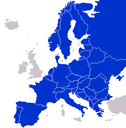
Continental-Europe-map.png (415 × 422 pikselōw, srogość zbioru: 12 KB, zorta MIME: image/png)
Gyszichta zbioru
Kliknij w datã/czas, żeby ôbejzdrzeć zbiōr, jak wtynczŏs wyglōndoł.
| Data i czas | Miniatura | Wymiary | Używŏcz | Kōmyntŏrz | |
|---|---|---|---|---|---|
| terŏźnŏ | 02:47, 8 wrz 2023 |  | 415 × 422 (12 KB) | Sariyr | Exit Vendsyssel-Thy (Denmark) |
| 09:06, 18 lip 2009 |  | 415 × 422 (14 KB) | Hoshie | redid Kosovo/Montenegro borders based on Cradel's older map; anti-alasing has been removed. | |
| 11:18, 27 wrz 2008 |  | 415 × 422 (14 KB) | Hoshie | readded Kosovo in a different way. See talk. | |
| 04:18, 25 wrz 2008 |  | 415 × 422 (14 KB) | Hoshie | added Montenegro and fix the tripoint between Albania, Serbia/Kosovo and Montenegro | |
| 16:40, 16 wrz 2008 |  | 415 × 422 (10 KB) | Tocino | Reverted to version as of 00:00, 16 September 2008 | |
| 11:06, 16 wrz 2008 |  | 415 × 422 (10 KB) | Cradel | Reverted to version as of 20:45, 15 September 2008 | |
| 01:00, 16 wrz 2008 |  | 415 × 422 (10 KB) | Tocino | Reverted to version as of 17:25, 15 September 2008 | |
| 21:45, 15 wrz 2008 |  | 415 × 422 (10 KB) | Cradel | Reverted to version as of 11:56, 14 September 2008 | |
| 18:25, 15 wrz 2008 |  | 415 × 422 (10 KB) | Tocino | Reverted to version as of 14:24, 12 January 2008 | |
| 12:56, 14 wrz 2008 |  | 415 × 422 (10 KB) | Cradel | fix |
Użycie zbioru
Żŏdnŏ strōna niy używŏ tego zbioru.
Globalne użycie zbioru
Tyn zbiōr je używany tyż we inkszych projektach wiki:
- Użycie we de.wikipedia.org
- Użycie we en.wikipedia.org
- Użycie we pl.wikipedia.org


